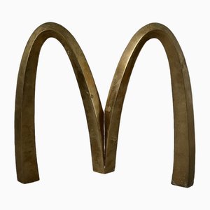
Mac Donald's Sign in Brass, 1970
CA$1,830
You are now following Wall Decor. You can manage alerts in your account settings.
You have unfollowed Wall Decor.
Mac Donald's Sign in Brass, 1970
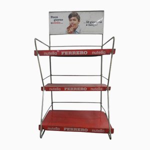
Nutella Ferrero Display, 1968
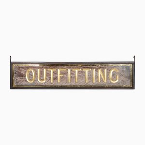
Antique Victorian Mirrored Outfitting Sign from Harris Tweed, 1900s
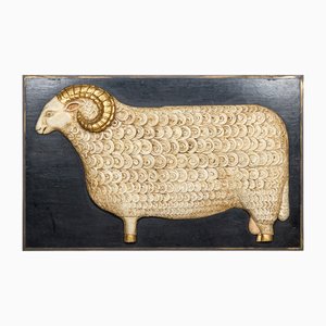
Carved Wood Sheep Sign, Cotswolds, 1970
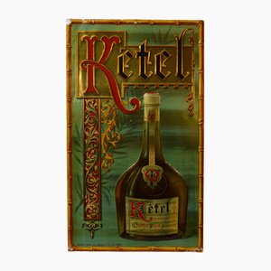
Kétel Liqueur Lithograph in Sheet Metal, 1930s
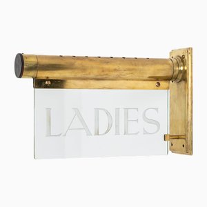
Wall Mounted Internalite Ladies Illuminated Sign, 1920s
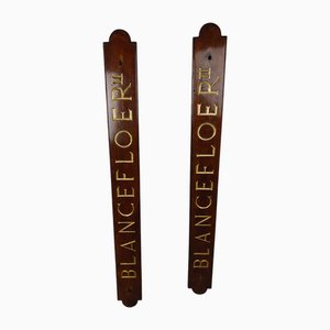
Blanceflower Shipboards in Mahogany, 1950s, Set of 2
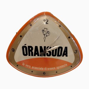
Working Advertising Clock, 1940s
Yamaha Musical Instruments Product Sign in Black and Gold, 1980s

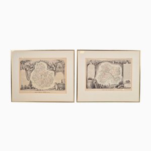
Antique Levasseur La Marne & Cote d'Or Wine Maps, 1852, Set of 2
Victorian Architectural Salvage Bronze Sign, 1890s
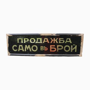
Cash Only Sign Framed Glass in Cyrillic, 1940s
Bone Structure Medical Chart, 1947

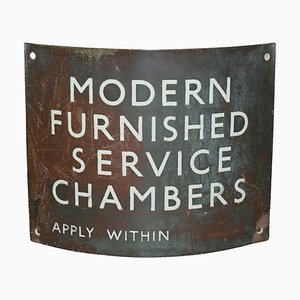
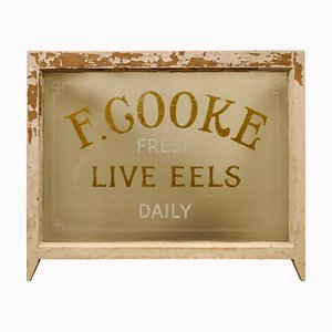
Advertising Bakers Shop Sign
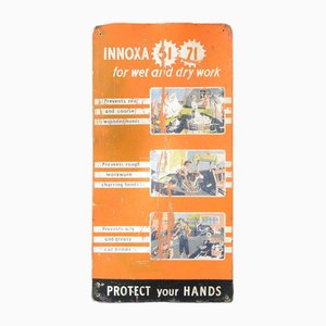
WW2 Innoxa Advertising Sign, 1940s
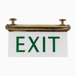
Flambosign Illuminated Exit Sign, 1930s
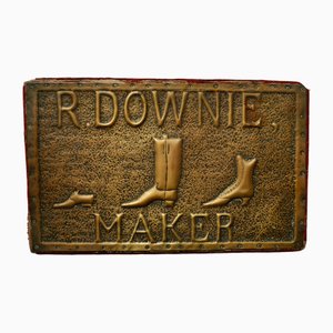
Victorian Shoe Makers Shop Sign, 1840s
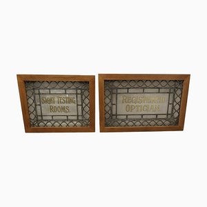
Large Leaded Glass Opticians Window Signs, 1900, Set of 2
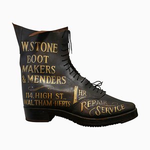
Edwardian Leather Boot Shoe Shop Display Sign, 1900s
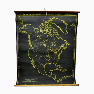
Black University Chart Map of North America, 1920s
Mid-Century Ladies Dame Public Toilet Sign in Metal, South of France, 1950s

Etched Glass Advertising Sign, 1930s
Shoe Shop Mirror Advertising Sign A S & Sons Shore Pedic Shoes, 1920s

Large Art Deco Decorative Advertising Sign, 1920s
Edwardian Hanging Kirbys Shop Sign, 1910s

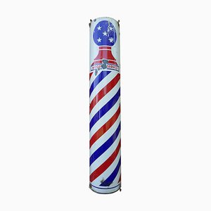
Porcelain Enamel Barbers Pole Shop Sign, 1930s
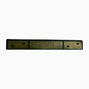
Hovis Etched Glass Bakery Advertising Window Sign, 1900s
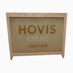
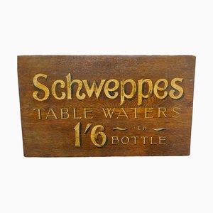
Table Waters Oak Trade Sign Board from Schweppes, 1940s
Crawfords Biscuits Baker-Cafe Advertising Mirror, 1950s

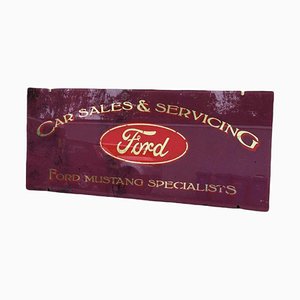
Ford Mustang Glass Garage Shop Sign
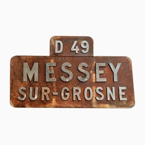
Vintage French Place Name Sign Messey-Sur-Grosne
Vintage French Butchers Horse Head Trade Sign, 1930s

Antique Letter in Brass

Vintage Letter in Brass, 1920s

Vintage Letter in Brass, 1920s

Vintage Gin & Tonic Original Letters, Set of 9

Early 20th Century Hand-Painted Trade Sign
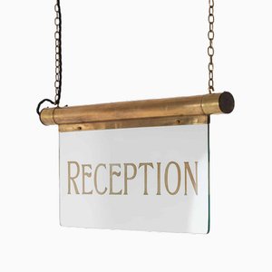
Art Deco Reception Illuminated Sign in Brass
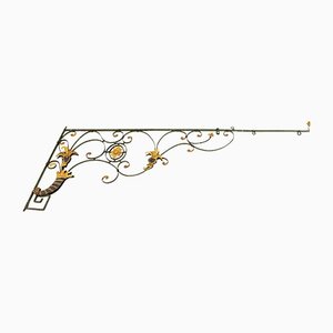
18th Century South German Iron Sign Bracket
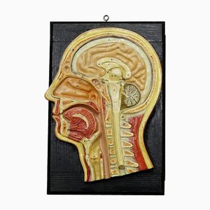
Antique Teaching Aid Median Incision of the Human Head, 1920s
French White Zinc Letter A, 1950s

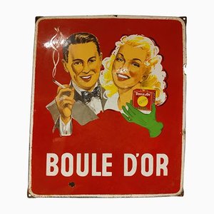
Vintage Advertising Boule Dor Enamel Sign, 1953
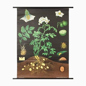
Vintage Botanical West German Biology Print Chart by Hagemann, Germany, 1960s
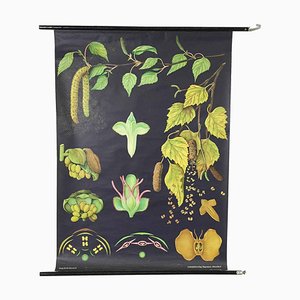
West German Botanical Biology Chart from Hagemann, Germany, 1964
Antique Hand-Painted Wooden Mayflower Shop Sign

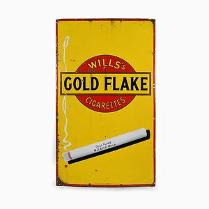
Enamel Sign Advertising Gold Flake
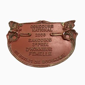
Red Sancoins Agricultural Contest Plaque, 2006
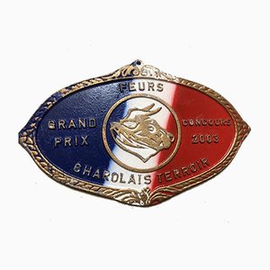
Agricultural Competition Blue White Red Plaque, 2003
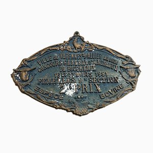
Blue Concours Agricole Varennes-sur-Allier Sign, 1991
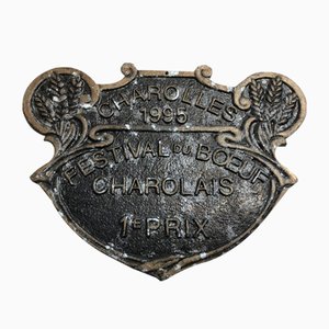
Concours Agricole Charolles Sign, 1995
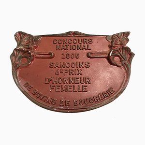
Red Sancoins Agricultural Contest Sign, 2005
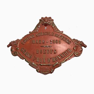
Concours Agricole Comice de Feurs Sign, 2001
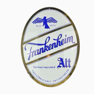
Enameled Metal Frankenheim Sign, 1960s
Brass Cesare Sign, 1980s

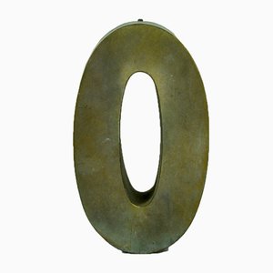
Brass Letter O, 1960s
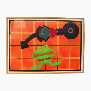
Poster from Atelier Fornasetti, 1990s
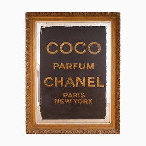
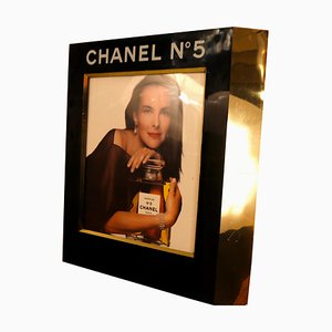
Retail Advertisement Display with Light for Chanel No. 5 by Chanel, 1980s
Poster by Renato Volpini, 1970s
Poster by Renato Volpini, 1972
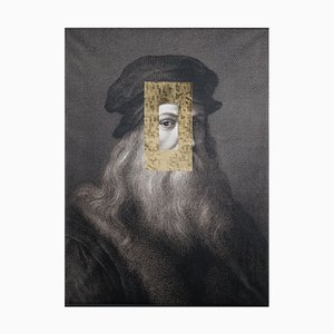
Leonardo Viso Print on Board by Marco Segantin for VGnewtrend
Vintage Black Lacquered Wooden Photo Album with Fish Motif, 1960s

Sin Título 7 Photograph by Juanjosé Fernández

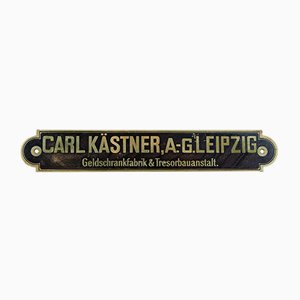
Carl Kästner Tresorbauanstalt Sign, 1920s
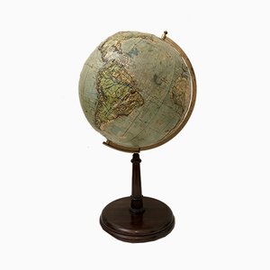
Vintage Relief Globe from Vallardi
Vintage Slate Globe from Räths

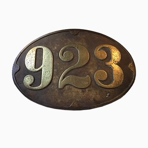
Antique Bronze Train Sign, 1910s
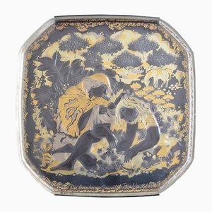
Vintage Glass Wall Plate by Bjørn Wiinblad for Rosenthal
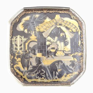
Vintage Glass Wall Plate by Bjørn Wiinblad for Rosenthal
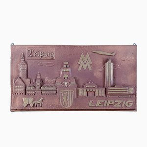
Metal Leipzig Mural Sign, 1970s
Italian Shop Sign, 1950s

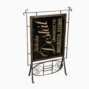
Letter Painter Kvetoslav Dostal Shop Sign, ca. 1900
Trending